
Wild Atlantic Aways · Things to Do · Walks & hikes
Hiking and walks in Kerry
Our homes are on the north side of the Dingle Peninsula, under Mount Brandon, and in Listowel. From the door you have a proper mountain, a corrie lake by the Conor Pass, forest trails and miles of flat beach. Ireland’s highest peak, Carrauntoohil, is a little over an hour away. These are the walks in Kerry we send guests on, from flat Kerry walking trails to full mountain days, with the times and starting points we give them.
Walks and hikes near our homes at a glance
| Walk | What it is | Time on foot | Start | From our homes |
|---|---|---|---|---|
| Mount Brandon | Mountain, 952 m | Allow 4 to 5 hours | Faha, above Cloghane, or the Saint’s Road on the west side | 10 min from our Cloghane homes |
| Pedlar’s Lake | Corrie lake | A 10 minute scramble | Waterfall car park near the top of the Conor Pass | 15 min from Cloghane |
| Fermoyle Beach Walk | Beach and estuary loop | About an hour | Fermoyle Beach car park | Near Cloghane |
| Brandon Bay | Flat beach walk, 12 km of sand | As long as you like | Several beach access points | 8 min from our homes |
| Maharees Peninsula | Dunes and beaches | 1 to 2 hours | The Maharees road | 5 min from our homes |
| Glanteenassig Forest Park | Forest, lakes and boardwalk | 1 to 2 hours | Forest car park | About 25 min from Castlegregory |
| Tralee to Fenit Greenway | Old railway line, 13.6 km one way | Any length, out and back | Fenit village end | From The Lighthouse, Fenit |
| Cliff Walk Ballybunion | Cliff path | Under an hour for the loop | Castle car park, Ballybunion | 25 min from Listowel |
Walking times are for a steady pace in fair weather. Drive times are approximate and longer in summer traffic.
Our walking guides
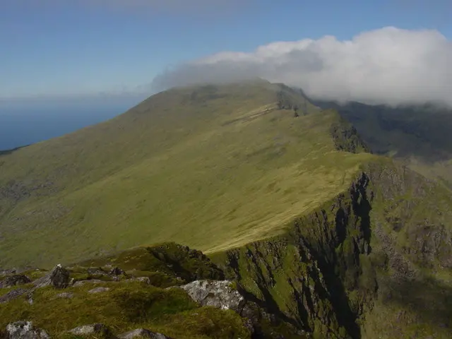
Mount Brandon
Mountain & hiking · 10 min from our homes
Best for hikers · allow 4-5 hours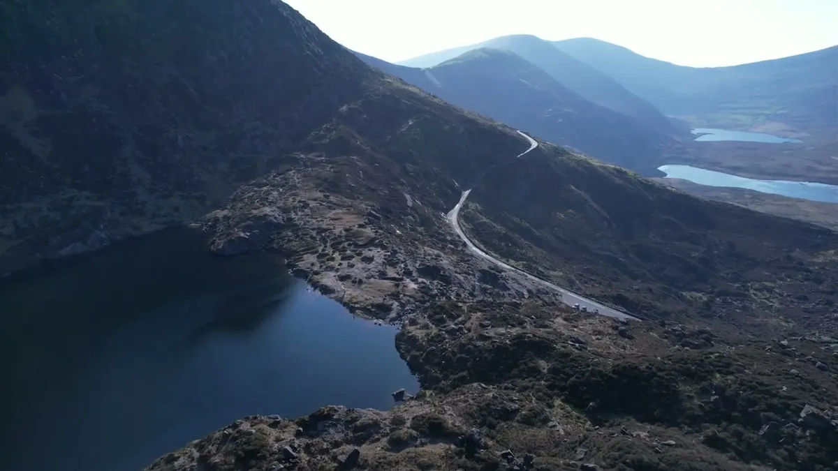
Pedlar’s Lake
Glacial lake · 15 min from our homes
Best paired with the Conor Pass drive · 15 min from Cloghane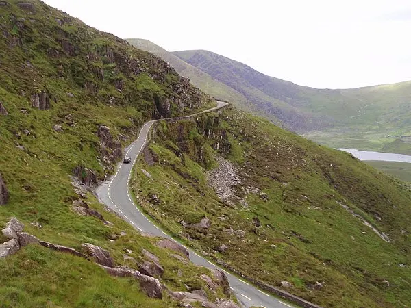
Conor Pass
Scenic drive · 20 min from our homes
Best for scenic drives · not for large vehicles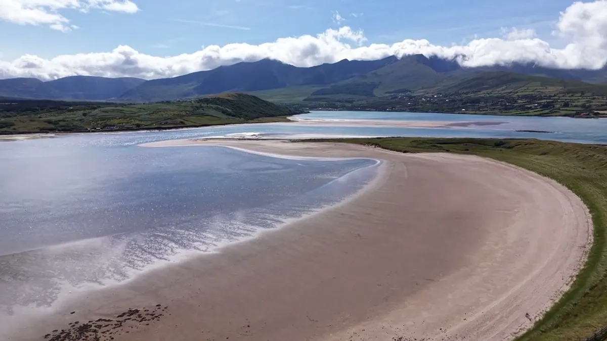
Fermoyle Beach
Beach
Beach walks near Cloghane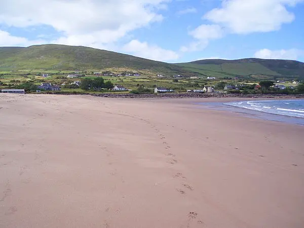
Brandon Bay
Beach & watersports · 8 min from our homes
Best for surfers & long walks
Maharees Peninsula
Beach & watersports · 5 min from our homes
Best for beaches & watersportsTralee to Fenit Greenway
Greenway
Walking and cycling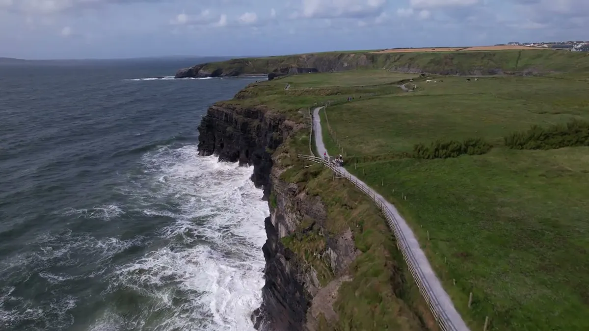
Cliff Walk Ballybunion
Cliff walk · 25 min from our homes
Best for a sunset walk · start at the castle car park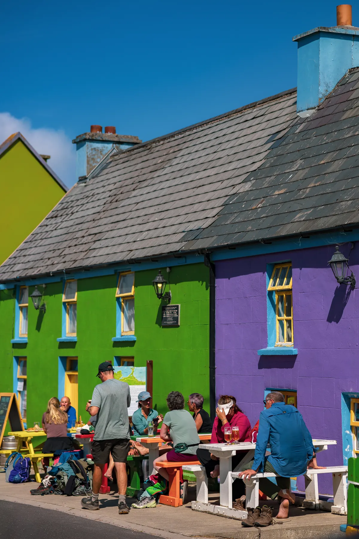
Cloghane Village
Village & pubs · 2 min from our homes
Best for an evening pint · walkable from our Cloghane homesMount Brandon
At 952 m Brandon is the highest Irish peak outside the MacGillycuddy’s Reeks. From our side of the mountain the classic route is the Faha path, marked from the grotto above Cloghane. It climbs past a chain of small lakes into a glacial coum before the steep pull to the summit ridge. The other way up is the Saint’s Road, the old pilgrim path from Ballybrack on the west side, marked by white crosses. Allow 4 to 5 hours either way. The weather turns fast here, so go on a clear forecast with a map, a compass and layers.
Pedlar’s Lake and the Conor Pass
From the waterfall car park near the top of the Conor Pass, a ten minute scramble brings you up to Pedlar’s Lake, a dark lake held in a ring of cliffs. Below the pass the Loch a’Duin valley runs quiet and wild, with old field walls and standing stones along the stream. You can be back at the car in an hour, or spend the afternoon there. The Conor Pass road itself is narrow and not suited to large vehicles.
Glanteenassig Forest Park
About 25 minutes from Castlegregory, Glanteenassig is a forested glen with two lakes, a boardwalk over the bog and gravel loops. It is the reliable choice for a soft day, and for small legs that will not manage a mountain.
Beach walks
The sand at Brandon Bay runs for about 12 km, and outside July and August you will often have long stretches to yourself. At its western end the Fermoyle Beach Walk loops round the headland in about an hour; check the tide first, as high water can cut off the return along the sand. The Maharees have dune paths between two bays, best at sunset.
The Dingle Way
The Dingle Way is a waymarked loop of about 160 km that starts and ends in Tralee. It passes through Camp, Castlegregory and Cloghane, so from most of our homes you can walk a stage and get a lift back. The stretch over the shoulder of Brandon between Cloghane and Ballydavid is the hardest day on the whole route.
North Kerry
From Listowel, the Ballybunion cliff walk starts at the castle car park and takes under an hour, past sea arches and the Nine Daughters Hole. The Tralee to Fenit Greenway follows the old railway for 13.6 km beside the estuary, flat enough for any age and shared with cyclists.
Bigger hikes further afield
Carrauntoohil from Cronin’s Yard
Ireland’s highest mountain, 1,039 m, in the MacGillycuddy’s Reeks. The usual approach is up the Hag’s Glen from Cronin’s Yard. The Devil’s Ladder gully is badly eroded and loose, so many walkers go up with a local mountain guide. About 70 to 75 min by car from Castlegregory, Camp or Listowel.
Torc Waterfall, Killarney National Park
A short walk from the car park to the falls, with longer marked trails into the woods above. An easy choice for mixed ages on a wet day. About 60 min by car from Castlegregory, Camp or Listowel.
Gap of Dunloe
A narrow mountain pass between the Reeks and Purple Mountain, roughly 11 km end to end on a quiet road past five lakes. Walk it, cycle it or take a jaunting car. About 75 to 80 min by car from Castlegregory, Camp or Listowel.
Before you set out
- Mountain weather changes within the hour. If cloud comes down on Brandon, turn back.
- Check tide times before any beach walk that rounds a headland.
- Much of the high ground is farmed. Keep dogs on a lead near sheep and close every gate.
- In an emergency call 112 or 999 and ask for Mountain Rescue.
Questions guests ask
What is the best hike near Castlegregory and Cloghane?
Mount Brandon. At 952 m it is the highest Irish peak outside the MacGillycuddy’s Reeks, and the Faha route starts just above Cloghane. Allow 4 to 5 hours and save it for a clear day.
Are there easy walks for children or a wet day?
Yes. The Fermoyle Beach Walk takes about an hour, Glanteenassig has forest loops and a boardwalk, the Fenit Greenway is flat and traffic free, and the Ballybunion cliff loop takes under an hour.
How far is Carrauntoohil from your houses?
About 70 to 75 minutes by car to Cronin’s Yard from Castlegregory or Camp, and about 70 minutes from Listowel. It is a full mountain day, so leave early.
Does the Dingle Way pass the houses?
Yes. The Dingle Way is a waymarked loop of about 160 km from Tralee, and it passes through Camp, Castlegregory and Cloghane, so you can walk a stage from most of our homes.
What should I do in an emergency on the hills?
Call 112 or 999 and ask for Mountain Rescue. Tell someone your route before you set out, and turn back if the cloud comes down.
Which Kerry walking trails are waymarked?
The Dingle Way through Camp, Castlegregory and Cloghane, the Tralee to Fenit Greenway, the forest loops at Glanteenassig and the Ballybunion cliff path are all marked. Mount Brandon and Pedlar’s Lake are open mountain, so bring a map and a compass.
What are the best hikes in Kerry within an hour of your homes?
Mount Brandon from Cloghane, Pedlar’s Lake at the Conor Pass, the Fermoyle Beach loop and the dune paths of the Maharees. Carrauntoohil, Torc Waterfall and the Gap of Dunloe are a little over an hour away by car.